About Trimble GNSS SP20 Handheld Receiver
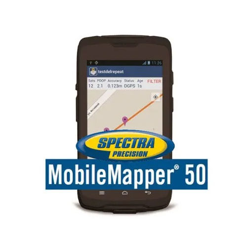
Discover the sizzling potential of the Trimble GNSS SP20 Handheld Receiver-where sublime precision meets unbeatable price for a limited time! This potent device runs on Android 6.0 with a quad-core 1.3 GHz ARM Cortex-A53 processor, ensuring seamless field data capture. The invincible IP65 rating provides rugged protection against dust and water. Capture every detail with an 8 MP rear camera and sunlight-readable HD touchscreen. With multi-constellation GNSS, lightning-fast 5 Hz updates, up to 10 hours of battery backup, and support for premium correction services, it's the fieldwork powerhouse you've been waiting for!
Trimble GNSS SP20 Competitive Advantages and Versatile Applications
The Trimble GNSS SP20 Handheld Receiver stands out for its invincible accuracy, robust design, and sublime usability. Used by surveying professionals, GIS experts, and field researchers, it is ideal for mapping, environmental monitoring, and geospatial data collection. Its unmatched connectivity, sunlight-readable display, and potent processing power ensure reliability in harsh conditions. From real-time corrections to versatile data formats, this device brings unparalleled competitiveness to those needing precision and ease in field applications.
Export Markets, Certification, and Sample Supply Benefits
Trimble GNSS SP20 enjoys premium demand in international markets, supported by robust supply chains in Asia, Europe, Africa, and beyond. Certified for performance and environmental standards, it ensures unmatched reliability. Samples can be requested for evaluation-just ask for a competitive quotation. As a trusted supplier and trader in India, we emphasize quality and prompt support, making it a smart choice for enterprises seeking field-ready technology with guaranteed certification and flexible export capabilities.
FAQ's of Trimble GNSS SP20 Handheld Receiver:
Q: How does the Trimble GNSS SP20 enhance field data collection?
A: The Trimble GNSS SP20 delivers centimeter to sub-meter level accuracy, fast 5 Hz positioning updates, and robust connectivity, making data collection in GIS, surveying, and mapping seamless and efficient.
Q: What environments can the SP20 be used in?
A: Thanks to its IP65 dust and water resistance and operational temperature range from -10C to +50C, the SP20 is suited for use in harsh outdoor conditions and challenging weather environments.
Q: When should I consider using the Trimble GNSS SP20 for a project?
A: Choose the SP20 whenever your work demands high-precision geospatial data, such as in GIS analysis, environmental monitoring, land surveying, or infrastructure mapping, where rugged reliability is essential.
Q: What certifications and export support are available for the SP20?
A: The SP20 comes with industry-standard certifications for quality and environmental conditions, and it is backed by comprehensive supply and export support for global markets.
Q: How is data managed and exported using the SP20 receiver?
A: The device supports multiple data formats including GIS, CSV, and SHP files, with 32 GB internal storage plus microSD expandability, ensuring easy data management and export for downstream processing.




 Send Inquiry


 Send Inquiry