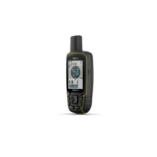
Garmin MAP 65s GPS
Garmin MAP 65s GPS

Garmin MAP 65s GPS

Garmin MAP 65s GPS Specification

  • Weight
  • 217.6 g (with batteries)
  • Memory Size
  • 16 GB internal memory, microSD card slot
  • Interface Type
  • USB, Bluetooth
  • Usage & Applications
  • Hiking, geocaching, outdoor exploration, mapping
  • Features
  • ABC sensors (altimeter, barometer, compass), wireless connectivity, multi-band GNSS, TopoActive maps, waypoint and track management
  • Type
  • Handheld GPS
  • Usage
  • Outdoor navigation, hiking, trekking, geocaching
  • Function
  • Mapping, waypoint marking, route tracking, navigation
  • Dimensions
  • 6.2 x 16.0 x 3.5 cm
  • Network
  • USB, Bluetooth
  • GPS Accuracy
  • Up to ±3 meters with Multi-GNSS
  • GPS Sensitivity
  • High-sensitivity multi-band GPS, GLONASS, Galileo, QZSS, IRNSS
  • Battery Backup
  • Up to 16 hours
  • Display
  • 2.6 transflective color TFT, 160 x 240 pixels
  • Frequency
  • Multi-band (L1/L5, etc.)
  • Operating Temperature
  • -20°C to 70°C
  • Wireless Connectivity
  • Bluetooth, ANT+
  • Battery Type
  • 2 x AA batteries (NiMH, Lithium, or Alkaline)
  • Water Rating
  • IPX7
  • Barometric Altimeter
  • Yes
  • Case Material
  • Rugged, durable plastic
  • Geocaching Support
  • Yes, paperless geocaching
  • Routes
  • 200
  • Electronic Compass
  • 3-axis with tilt compensation
  • Track Log
  • 10,000 points, 200 saved tracks
  • Map Support
  • TopoActive, BirdsEye Satellite, custom maps
  • Waypoints
  • 5,000


About Garmin MAP 65s GPS


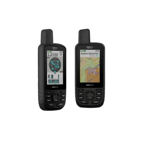
Jump on the opportunity to experience the exclusive Garmin MAP 65s GPS-a rare gem in outdoor navigation. Designed with a rugged, classic case and optimum performance, it's packed with the best mapping features, including TopoActive, BirdsEye Satellite, and custom maps. Navigate with rare accuracy using high-sensitivity multi-band GPS, GLONASS, Galileo, and more. Store up to 5,000 waypoints, track 200 routes, and access advanced ABC sensors for barometric and compass readings. Ideal for trekking, hiking, and geocaching, this handheld GPS is built for adventure.

Garmin MAP 65s GPS: Competitive Edge and Key Applications

With rare multi-band frequency support and optimum 3-axis tilt-compensated compass, the Garmin MAP 65s stands out as a classic choice among handheld GPS devices. Applications span hiking, trekking, geocaching, and precise mapping. Widely used by outdoor enthusiasts, geocachers, and professional explorers in India, its best-in-class ABC sensors and wireless connectivity deliver powerful navigation advantages. Supported by numerous application media and supplier networks, it's the go-to tool for critical outdoor orientation.


Sample Policy, Transportation, and Delivery

Garmin MAP 65s GPS samples are dispatched efficiently, with flexible sample policies designed for supplier and trader satisfaction. FOB port handling is available for smooth international transportation. Products are delivered at competitive rates, ensuring timely arrival. Standard delivery time ranges from a few days to two weeks, depending on location and specific requirements. Each shipment is securely packaged for optimum safety, so you can jump on the latest in GPS technology with complete peace of mind.


FAQ's of Garmin MAP 65s GPS:


Q: How does the Garmin MAP 65s GPS ensure navigation accuracy?

A: The GPS uses high-sensitivity multi-band GNSS technology, accessing GPS, GLONASS, Galileo, QZSS, and IRNSS for optimum accuracy, achieving up to 3 meters.

Q: What is the battery life and type for the Garmin MAP 65s GPS?

A: The handheld device operates on 2 AA batteries (NiMH, Lithium, or Alkaline) and provides up to 16 hours of battery backup, supporting extended outdoor journeys.

Q: Where can the Garmin MAP 65s GPS be used effectively?

A: It's ideally used for outdoor navigation tasks such as hiking, trekking, mapping, and paperless geocaching, with durable, water-rated (IPX7) construction for challenging environments.

Q: What application media and maps does the Garmin MAP 65s support?

A: The unit supports TopoActive, BirdsEye Satellite, and custom maps, ensuring users have access to a variety of mapping sources for reliable route and waypoint management.

Q: How can users transfer data or connect wirelessly with the device?

A: Data transfer is seamless via USB or Bluetooth, and the device also includes ANT+ for wireless connectivity with compatible sensors and devices.

Q: What is the process for ordering and delivery in India?

A: Orders are processed through suppliers and traders, with products dispatched via FOB ports. The rate and transportation method ensure secure, prompt delivery within a specific timeframe.

Tell us about your requirement
product

Price:

Quantity
Select Unit

  • 50
  • 100
  • 200
  • 250
  • 500
  • 1000+
Additional detail
Mobile number

Email

More Products in GARMIN GPS Handhelds Category

GARMIN 66SR GPS

GARMIN 66SR GPS

Features : Multiband GNSS, barometric altimeter, 3axis compass, wireless connectivity, rugged design

Frequency : Multifrequency (L1/L5 bands)

Function : Other, Handheld GPS receiver with precise positioning and mapping capability

Memory Size : 16 GB internal memory, microSD slot (up to 32 GB)

Network : No cellular, GNSS satellite connectivity

Type : Other, Handheld Multiband GPS

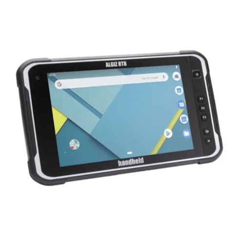
Algiz RT8 Rugged Tablet

Algiz RT8 Rugged Tablet

Features : IP67 rated, MILSTD810G, Glove and Rain Touch, Integrated GPS, Rear and Front Cameras

Frequency : Global LTE bands supported

Function : Other, Data Collection, GPS Navigation, Field Work

Memory Size : 4 GB RAM, 64 GB eMMC

Network : 4G LTE, WiFi 802.11 a/b/g/n/ac, Bluetooth 5.0

Type : Other, Rugged Tablet

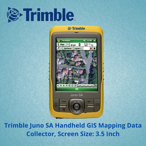
Trimble Juno SA Handheld GIS Mapping Data Collector GPS

Trimble Juno SA Handheld GIS Mapping Data Collector GPS

Features : Rugged Design, Builtin Camera, Windows Mobile 6.5, Touchscreen

Frequency : Integrated GPS L1 C/A code

Function : Other, Handheld GIS Mapping and Data Collection

Memory Size : 128 MB RAM / 4 GB Flash

Network : Integrated Bluetooth and WiFi

Type : Other, Handheld Data Collector GPS

Trimble GNSS SP20 Handheld Receiver

Trimble GNSS SP20 Handheld Receiver

Features : Rugged, IP65 rated, integrated camera, scalable positioning

Frequency : Multiconstellation GNSS (GPS, GLONASS, Galileo, BeiDou)

Function : Other, GNSS (Global Navigation Satellite System) handheld receiver

Memory Size : 32 GB internal storage, microSD card expandable

Network : WiFi, Bluetooth, Cellular (4G LTE)

Type : Other, Handheld GNSS Receiver


Back to top