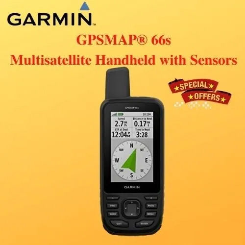
Garmin GPSMAP 66sr Handheld GPS

Garmin GPSMAP 66sr Handheld GPS

Garmin GPSMAP 66sr Handheld GPS Specification

  • Memory Size
  • 16 GB internal memory; microSD card slot for expandable storage
  • Interface Type
  • USB, Bluetooth, Wi-Fi
  • Features
  • TopoActive maps, multi-band GNSS support, ABC sensors (altimeter, barometer, compass), geocaching live, smart notifications, waypoint navigation, rugged/water-resistant design (IPX7)
  • Usage & Applications
  • Hiking, backpacking, mountaineering, geocaching, field surveying, expeditions, outdoor adventure
  • Type
  • Handheld GPS device
  • Usage
  • Outdoor navigation, trekking, surveying, adventure activities
  • Function
  • Handheld navigation, mapping, tracking, geocaching, and waypoint marking
  • Dimensions
  • 6.2 x 16.3 x 3.5 cm
  • Weight
  • Approx. 252 g with batteries
  • Network
  • Wireless connectivity via Bluetooth and Wi-Fi
  • GPS Accuracy
  • Multi-band GNSS for improved location accuracy, typically within a few meters
  • GPS Sensitivity
  • High-sensitivity, multi-band GNSS with GPS, GLONASS, Galileo, QZSS and IRNSS support
  • Battery Backup
  • Up to 36 hours in GPS mode; up to 450 hours in Expedition mode
  • Display
  • 3-inch sunlight-readable color display (240 x 400 pixels)
  • Frequency
  • Operates across multiple GNSS frequencies
  • USB
  • High-speed USB
  • Water Rating
  • IPX7 (Waterproof)
  • Operating Temperature Range
  • -20°C to 60°C (-4°F to 140°F)
  • Track Log
  • 20,000 points, 250 saved tracks
  • Battery Type
  • 2 AA batteries (NiMH, Lithium, or Alkaline)
  • Battery Life (Expedition Mode)
  • Up to 450 hours
  • Physical Protection
  • Rugged design, water and shock-resistant
  • Altimeter Type
  • Barometric
  • Waypoints
  • 10,000 waypoints and 250 routes
  • Wireless Capabilities
  • ANT+ and Bluetooth technology
  • User Interface
  • Button operated
  • Compass Type
  • Tilt-compensated 3-axis
  • Positioning System
  • GPS, GLONASS, Galileo, QZSS, IRNSS
  • Geocaching Features
  • Paperless geocaching, live geocaching
  • Map Support
  • Preloaded TopoActive maps, supports custom maps


About Garmin GPSMAP 66sr Handheld GPS


Unlock excellent navigation with the Garmin GPSMAP 66sr Handheld GPS devicea kingly companion for outdoor adventurers and explorers. Its highly customizable interface and polished build offer a rugged, water-resistant (IPX7) exterior, ideal for trekking, surveying, and geocaching. Instantly checkout with a device that boasts multi-band GNSS support for unrivaled accuracy. Capture up to 10,000 waypoints, 250 routes, and access preloaded TopoActive maps or add your own. Equipped with smart notifications, Bluetooth and Wi-Fi, this GPS ensures a seamless, royal-grade navigation experience wherever your journey leads.

Versatile Application and Premium Features

The Garmin GPSMAP 66sr Handheld GPS is designed for stamina and precision. Users can easily mark waypoints, track progress, and utilize real-time mapping. Enjoy extra custom features like preloaded TopoActive maps, wireless connectivity via Bluetooth and Wi-Fi, and advanced ABC sensors. This device adapts to hiking, mountaineering, surveying, and geocaching, thanks to its rugged waterproof design and sunlight-readable display. Its instant interface supports both amateur adventurers and seasoned professionals alike.


Competitive Pricing, Express Delivery, and Global Reach

We offer Garmin GPSMAP 66sr at the lowest price compared to the standard list price, ensuring great value for suppliers and traders. Quick freight options guarantee prompt delivery time across India and key export markets worldwide. Expect seamless order processing and diligent after-sales support for all purchases. Reach out for detailed payment terms, including flexible arrangements tailored for bulk orders and international clients, so you can unlock your adventures without delay.


FAQs of Garmin GPSMAP 66sr Handheld GPS:


Q: How does the waterproof rating of IPX7 benefit my outdoor activities?

A: The IPX7 waterproof rating ensures your Garmin GPSMAP 66sr can withstand splashes, rain, and accidental submersion, making it highly reliable for rugged environments and unpredictable weather during outdoor adventures.

Q: What customization features does the GPSMAP 66sr offer for maps and waypoints?

A: You can customize your device by adding your own maps using the microSD slot, save up to 10,000 waypoints and 250 routes, and quickly navigate or track specific areas. This flexibility suits all types of navigation and surveying needs.

Q: Where can the Garmin GPSMAP 66sr be used effectively?

A: This handheld GPS thrives in diverse environments, including mountains, forests, urban hiking routes, and off-road expeditions. Its ruggedness and high-sensitivity GNSS make it suitable for hiking, backpacking, mountaineering, and professional surveying.

Q: What is the process for updating maps and software on the device?

A: Updating maps and software is straightforward using the built-in Wi-Fi or USB connection. Connect the device to Garmins update platform to download the latest TopoActive maps and system improvements, ensuring ongoing accuracy and performance.

Q: When should I use Expedition Mode versus GPS mode?

A: Expedition Mode is ideal for extended trips, offering up to 450 hours of battery life by minimizing non-essential functions. Use standard GPS mode for regular tracking and navigation, which provides up to 36 hours of battery backup.

Q: How can instant wireless connectivity enhance my navigation experience?

A: Instant Bluetooth and Wi-Fi connectivity let you quickly sync waypoints, receive smart notifications, and access live geocaching features, streamlining your planning and route management while on the move.

Tell us about your requirement
product

Price:

Quantity
Select Unit

  • 50
  • 100
  • 200
  • 250
  • 500
  • 1000+
Additional detail
Mobile number

Email

More Products in GARMIN GPS Handhelds Category

GARMIN Oregon 550 Handheld GPS

GARMIN Oregon 550 Handheld GPS

Weight : 6.8 oz (192.7 g) with batteries

Usage : Other, Outdoor navigation, hiking, adventure, camping

Type : Other, Handheld GPS

Dimensions : 2.3 x 4.5 x 1.4 (58 x 114 x 35 mm)

Features : 3axis compass, barometric altimeter, IPX7 waterproof, geotagging with integrated 3.2MP camera, sunlightreadable touchscreen

Function : Other, Handheld GPS navigation, geotagging, mapping

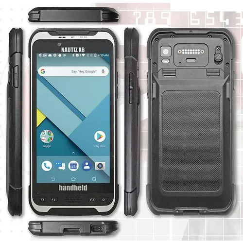
NAUTIZ X6 Handheld GIS Data Collector

NAUTIZ X6 Handheld GIS Data Collector

Weight : 490 g

Usage : Other, Field Data Collection, Surveying, GIS Mapping

Type : Other, Rugged Android PDA

Dimensions : 192 mm x 92 mm x 14.6 mm

Features : IP67 Waterproof & Dustproof, MILSTD810G Rugged, Integrated GNSS, Dual SIM, Front and Rear Camera

Function : Other, Handheld GIS Data Collector

Trimble Juno SA Handheld GIS Mapping Data Collector GPS

Trimble Juno SA Handheld GIS Mapping Data Collector GPS

Weight : 0.18 kg

Usage : Other, Field Data Mapping, Asset Management, Environmental Surveys

Type : Other, Handheld Data Collector GPS

Dimensions : 134 mm x 74 mm x 21 mm

Features : Rugged Design, Builtin Camera, Windows Mobile 6.5, Touchscreen

Function : Other, Handheld GIS Mapping and Data Collection

GARMIN Oregon 650 GPS

GARMIN Oregon 650 GPS

Weight : 209.8 g (7.4 oz) with batteries

Usage : Other, Handheld outdoor GPS

Type : Other, Handheld GPS device

Dimensions : 6.1 x 11.4 x 3.3 cm (2.4 x 4.5 x 1.3)

Features : 3axis electronic compass, accelerometer, barometric altimeter, wireless sharing, dual battery system, touchscreen

Function : Other, Navigation, mapping, route planning


Back to top