About Trimble Juno SA Handheld GIS Mapping Data Collector GPS
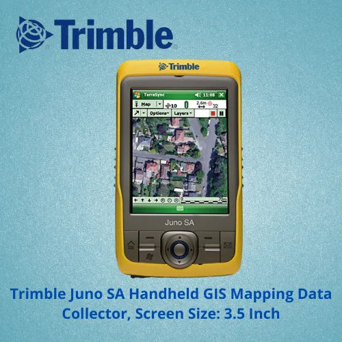
Explore the unrivaled capabilities of the Trimble Juno SA Handheld GIS Mapping Data Collector GPS. This paragon of field technology boasts a powerful 533 MHz Samsung processor, kingly durability with IP54 water and dust resistance, and a highlighted suite of features like a 3 MP autofocus camera and 10-hour battery backup. Experience kingly mapping accuracy of 2-5 meters, integrated Bluetooth and Wi-Fi, and easy data exchange via mini USB. Achieve unmatched performance in utility mapping, agriculture, forestry, and asset data collection-now available at clearance rates from India's premier supplier.
Key Features & Applications
Highlighted by its rugged design and intuitive touchscreen, the Trimble Juno SA stands out for field-ready reliability. Its IP54-rated enclosure guards against environmental hazards, while the built-in camera, integrated GPS, and powerful software compatibility streamline asset tracking, utility mapping, and environmental monitoring. Direction for use is straightforward: simply power on, select your preferred GIS software, and start capturing precise geospatial data for plant applications, environmental surveys, and asset management initiatives.
FOB Port, Sample, and Packaging Details
The Trimble Juno SA Handheld GIS Mapping Data Collector GPS has an established FOB port in India, reflecting reliable exchange and market value. Samples may be available on request for qualified clients, allowing for informed outlay decisions prior to bulk procurement. Each unit is thoughtfully packaged to ensure safe transit, preserving its unrivaled integrity and kingly functionality from dispatch to delivery-supporting seamless integration into your field operations.
FAQ's of Trimble Juno SA Handheld GIS Mapping Data Collector GPS:
Q: How is the Trimble Juno SA Handheld GIS Mapping Data Collector GPS typically used in the field?
A: The Trimble Juno SA is designed for seamless field data collection, mapping, and environmental surveys. Users simply power on the unit, launch compatible GIS software, and begin collecting and managing asset or site data with high accuracy.
Q: What software platforms are compatible with the Trimble Juno SA device?
A: This device supports Trimble TerraSync, GPS Controller, ArcPad, and other GIS mapping and data management software, offering flexibility for a range of professional applications and workflows.
Q: Where can the Trimble Juno SA be utilized most effectively?
A: It excels in utilities mapping, forestry, agriculture, environmental monitoring, asset data collection, and remote field survey operations, owing to its rugged IP54 design and wide temperature tolerance.
Q: What are the steps involved in setting up the Trimble Juno SA for first-time use?
A: Initial setup involves charging the device, inserting a microSD card for expansion if needed, powering on, configuring the Windows Mobile 6.5 system, and installing or launching required GIS software.
Q: When should the device's battery be recharged for optimal usage?
A: The built-in 3060 mAh battery provides up to 10 hours of continuous operation. It is recommended to recharge the battery after each full day of use or as soon as the battery indicator shows low power.
Q: What are the key benefits of using this data collector for field mapping projects?
A: Benefits include targeted accuracy (2-5 meters), unrivaled durability in tough environments, seamless data exchange via Bluetooth and Wi-Fi, and compatibility with an array of software solutions to suit multiple industries.




 Send Inquiry


 Send Inquiry