About Spectra Geospatial SP85 GNSS RTK GPS
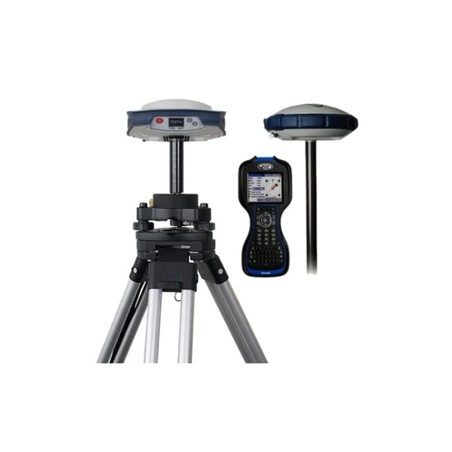
The Spectra Geospatial SP85 GNSS RTK GPS stands as a top choice for land surveying, construction, and geospatial data work. This cost-effective, decorated receiver boasts a noteworthy operating temperature range of -40C to +65C and IP67 dust/water protection. Surviving 2 m drops onto concrete, the marvelous SP85 offers centimeter-level accuracy, 7,600 mAh hot-swappable batteries, and advanced anti-jamming. With 480 multi-frequency channels, versatile data support, 4G LTE connectivity, and user-friendly Web UI, it remains an industry-leading and robust surveying solution for India's challenging environments.
Versatile Applications and Usage Guidance
The Spectra Geospatial SP85 GNSS RTK GPS is marvelously suitable for land surveying, stakeout, GIS data collection, and cadastral survey tasks. Its decorated rugged design makes it perfect for rough outdoor surfaces and construction environments. For optimal results, users should configure the unit using its Web UI or smartphone and select base or rover mode as required. The device is easily operated atop survey tripods or vehicles, ensuring reliable, precise measurements regardless of the surface of application.
Certifications, Samples, and Packaging Information
Spectra Geospatial SP85 GNSS RTK GPS is delivered with noteworthy certifications and compliance documentation, supporting professional credibility. Sample units can be provided upon proposal acceptance, helping customers evaluate suitability before dispatching bulk orders. Packaging is meticulously designed to protect each unit during transit, ensuring safe arrival. Rates and payment terms are tailored per proposal amount, offering flexibility for organizations in India. All dispatching processes adhere to industry standards for quick and reliable delivery.
FAQ's of Spectra Geospatial SP85 GNSS RTK GPS:
Q: How does the Spectra Geospatial SP85 GNSS RTK GPS benefit land surveyors and construction professionals?
A: The SP85 offers superior centimeter-level accuracy, rugged shock resistance, versatile data formats, and reliable connectivity, making it ideal for precise and efficient land surveying, stakeout, and construction site measurements.
Q: What surfaces and environments is the SP85 GNSS RTK GPS suitable for use in?
A: The device is decorated for outdoor conditions, with IP67 dust and water protection and an operating range of -40C to +65C, so it works reliably on construction sites, uneven terrains, and harsh environments.
Q: How do I set up and use the SP85 GNSS RTK GPS for data collection?
A: Users can configure the SP85 via its Web UI or smartphone compatibility, select between base or rover mode, and deploy it on tripods or vehicles to capture high-precision GNSS data.
Q: What certifications and packaging details accompany the SP85 GNSS RTK GPS when purchasing in India?
A: Each unit is supplied with relevant certifications and professionally decorated packaging to ensure protected, compliant delivery, supporting project proposal and tender submissions.
Q: When can I request a sample unit of the Spectra Geospatial SP85 GNSS RTK GPS?
A: Sample units are available for evaluation upon submission and approval of a proposal amount, enabling clients to test the product prior to dispatching larger orders.



 Send Inquiry


 Send Inquiry