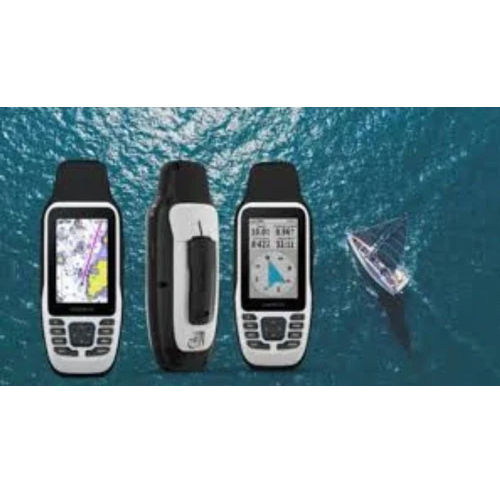
MAP 79S Garmin GPS
MAP 79S Garmin GPS

MAP 79S Garmin GPS

MAP 79S Garmin GPS Specification

  • Interface Type
  • USB, NMEA 0183
  • Features
  • High-Sensitivity Receiver, Rugged, Waterproof (IPX7), Floating design, Sunlight-readable display, Wireless data sharing
  • Weight
  • 226 g
  • Usage & Applications
  • Marine, Fishing, Boating, Outdoor Navigation
  • Memory Size
  • 8 GB Internal Memory
  • Type
  • Handheld GPS
  • Usage
  • Marine Navigation, Outdoor Activities
  • Function
  • Handheld Navigation and Positioning
  • Dimensions
  • 6.7 x 17.4 x 4.2 cm
  • Network
  • GPS, GLONASS, QZSS
  • GPS Accuracy
  • Within 3 meters (CEP)
  • GPS Sensitivity
  • -20 dBm
  • Battery Backup
  • Up to 19 hours
  • Display
  • 2.6-inch Colour TFT, 160 x 240 Pixels
  • Frequency
  • L1 (1575.42 MHz)
  • Operating Temperature Range
  • -15°C to 70°C (5°F to 158°F)
  • Barometric Altimeter
  • Yes
  • Electronic Compass
  • Yes (3-axis)
  • Data Storage
  • microSD card slot (up to 32 GB)
  • Waypoints
  • Up to 10,000
  • Track Log
  • Up to 20,000 points, 250 saved tracks
  • Wireless Connectivity
  • ANT+, Bluetooth
  • Supported Map Types
  • Worldwide Basemap, Optional BlueChart g3
  • Battery Type
  • 2 AA Batteries (not included)
  • Waterproof Rating
  • IPX7
  • Routes
  • Up to 250


About MAP 79S Garmin GPS


Take advantage of our Clearance offer to buy the preeminent MAP 79S Garmin GPS, a praiseworthy device for marine and outdoor navigation. This monumental handheld GPS boasts an IPX7 waterproof rating, worldwide basemap, optional BlueChart g3 support, and exceptional track and waypoint capacity. Experience precise navigation with its 3-axis electronic compass, barometric altimeter, and wireless connectivity (ANT+, Bluetooth). With rugged design, sunlight-readable display, floating construction, and up to 19 hours battery backup, the MAP 79S ensures reliability in challenging environments. Order now for remarkable performance!

Superior Navigation Power for Marine & Outdoor Professionals

The MAP 79S Garmin GPS stands out with its rugged waterproof construction, 2.6-inch sunlight-readable display, and advanced multi-GNSS support, ensuring high-accuracy navigation even in demanding conditions. Key features like a 3-axis electronic compass, barometric altimeter, and wireless data sharing elevate its utility. Ideal for marine, fishing, boating, and outdoor activities, its exceptional waypoint and track storage capacity makes it a top choice for professionals seeking durability and precision in navigation.


Expansive Reach, Fast Supply & Sample Accessibility

MAP 79S Garmin GPS meets robust export demand across India, delivering to traders and suppliers with quick dispatch and secure packing. Our supply ability accommodates bulk orders, ensuring your procurement process is seamless. Samples are available for assessment prior to purchase. With efficient packing & dispatch operations, clients enjoy prompt deliveries for immediate use, supporting rapid deployment for marine, outdoor, and industrial applications throughout major export markets.


FAQ's of MAP 79S Garmin GPS:


Q: How waterproof is the MAP 79S Garmin GPS, and where can it be used?

A: The MAP 79S Garmin GPS features an IPX7 waterproof rating, making it suitable for use in marine environments, fishing, boating, and various outdoor activities where exposure to water and harsh conditions is common.

Q: What are the main benefits of using the MAP 79S Garmin GPS for marine navigation?

A: This GPS offers high sensitivity, exceptional accuracy within 3 meters, a sunlight-readable display, floating design, and support for detailed marine maps, ensuring safe and reliable navigation in all weather and lighting conditions.

Q: How can I order the MAP 79S Garmin GPS and is quick dispatch possible?

A: You can order the MAP 79S Garmin GPS through our supplier and trader networks in India. We provide efficient packing and quick dispatch, ensuring timely delivery for both individual and bulk orders.

Q: What map types and data storage options does the device support?

A: The MAP 79S supports worldwide basemap and optional BlueChart g3 marine charts. It includes 8 GB internal memory and a microSD slot supporting up to 32 GB for additional map and data storage.

Q: What is the battery backup and operating range of temperatures for this device?

A: The GPS operates on 2 AA batteries (not included) and delivers up to 19 hours of battery backup, functioning reliably within a temperature range of -15C to 70C (5F to 158F).

Tell us about your requirement
product

Price:

Quantity
Select Unit

  • 50
  • 100
  • 200
  • 250
  • 500
  • 1000+
Additional detail
Mobile number

Email

More Products in GARMIN GPS Handhelds Category

GARMIN Montana 700 GPS

GARMIN Montana 700 GPS

Weight : 397 g (with batteries)

Memory Size : 16 GB internal; expandable with microSD card (up to 32 GB supported)

Usage & Applications : Hiking, Hunting, Biking, Geocaching, Offroad Navigation

Dimensions : 3.6 x 7.2 x 1.3 (9.19 x 18.32 x 3.28 cm)

Function : Other, Handheld Navigation, Mapping, Tracking, Waypoint Management

Features : Wireless Connectivity, TopoActive Maps, Rugged/Waterproof IPX7, Custom Routing
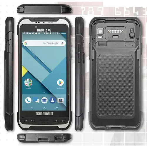
NAUTIZ X6 Handheld GIS Data Collector

NAUTIZ X6 Handheld GIS Data Collector

Weight : 490 g

Memory Size : 4 GB RAM / 64 GB ROM

Usage & Applications : GIS Survey, Forestry, Environmental Monitoring, Construction, Asset Management

Dimensions : 192 mm x 92 mm x 14.6 mm

Function : Other, Handheld GIS Data Collector

Features : IP67 Waterproof & Dustproof, MILSTD810G Rugged, Integrated GNSS, Dual SIM, Front and Rear Camera
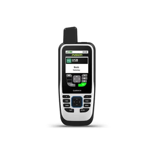
MAP 86S Garmin GPS

MAP 86S Garmin GPS

Weight : 272 g with batteries

Memory Size : 8 GB internal, microSD card slot

Usage & Applications : Marine, land, outdoor trekking, boating, navigation, geocaching

Dimensions : 6.8 x 17.8 x 4.3 cm

Function : Other, Handheld GPS navigation, mapping, waypoints, routes, tracks recording

Features : Wireless connectivity, preloaded maps, waterresistant (IPX7), floatable, SOS, barometric altimeter, 3axis compass
Garmin 64S GPS

Garmin 64S GPS

Weight : 230 g with batteries

Memory Size : 4 GB internal memory, microSD card slot

Usage & Applications : Trekking, hiking, field mapping, geocaching, outdoor adventure

Dimensions : 6.1 x 16.0 x 3.6 cm

Function : Other, Navigation and location tracking

Features : Wireless data sharing, hunt/fish calendar, sun/moon information, area calculation


Back to top