About GARMIN MAP 67 GPS
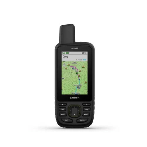
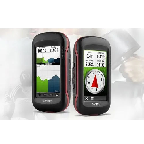
The GARMIN MAP 67 GPS is an in-demand, first-rate handheld navigation device highlighted for its unmatchable performance across terrains. Boasting impeccable waterproof IPX7 design, a robust rechargeable lithium-ion battery, and a high-sensitivity quad helix antenna, this GPS navigates with precision-accurate up to 3 meters. Users can find advanced features like a three-axis electronic compass, barometric altimeter, and support for multi-GNSS networks. With 10,000 waypoints, BirdsEye Satellite Imagery, and seamless Bluetooth/Wi-Fi connectivity, it is ideal for trekking, adventure, surveying, or mapping in diverse conditions-making it a standout device for outdoor enthusiasts and professionals.
Explore Advanced Navigation-Extraordinary Features and Uses
GARMIN MAP 67 GPS is engineered for outdoor navigation, mapping, adventure planning, and surveying. Highly rated for its extra features-including a color transflective display, real-time weather updates, TopoActive maps, and paperless geocaching-it excels in challenging environments. The multi-band GNSS support ensures precise tracking on difficult terrains. Bluetooth and Wi-Fi offer wireless updates and smart notifications, while rugged waterproof construction adds further appeal for trekkers, hikers, and professionals venturing into demanding landscapes.
Export, Valuation, and Supply-A Premium Mapping Solution
The GARMIN MAP 67 GPS commands attention in major export markets across India and beyond, reflecting a premium valuation and high performance. With a strong supply ability, suppliers and traders are equipped to meet robust demands at competitive list prices. Each GPS unit is safely packaged with battery and accessories in secure export-grade packaging, protecting your investment during transit. This high-value equipment is the choice for professionals seeking reliability, precision, and advanced features on every expedition.
FAQ's of GARMIN MAP 67 GPS:
Q: How does the waterproof IPX7 rating benefit users in outdoor environments?
A: The IPX7 waterproof rating ensures the GARMIN MAP 67 GPS remains functional and protected even in heavy rain, accidental submersion, or wet conditions-critical for outdoor adventurers, trekkers, and surveyors.
Q: What is the process for updating maps and software on this device?
A: Map and software updates can be easily performed wirelessly via the device's built-in Wi-Fi connectivity or through USB-C. This enables users to access the latest features and TopoActive maps on the go.
Q: Where can the GARMIN MAP 67 GPS be used effectively?
A: This GPS navigator excels in a wide range of settings: from trekking in rugged mountains, hiking forest trails, and surveying remote regions, to adventure planning across varied continents thanks to its multi-GNSS support and comprehensive mapping features.
Q: What special features distinguish the GARMIN MAP 67 GPS from other navigation devices?
A: Highlighted features include a three-axis tilt-compensated electronic compass, barometric altimeter, paperless geocaching, BirdsEye Satellite Imagery support, and multi-band GPS reception, ensuring unrivaled accuracy and versatility.
Q: How long does the battery last, and what are the charging options?
A: The rechargeable lithium-ion battery delivers up to 180 hours in expedition mode and 16 hours in standard GPS mode, chargeable conveniently via USB-C-perfect for longer adventures and professional use.
Q: What benefits do users gain from the large waypoint and track recording capacity?
A: With support for 10,000 waypoints, 250 routes, and 200 track recordings (20,000 points per track), users can meticulously plan, mark, and revisit important routes and locations-ideal for thorough mapping, complex expeditions, and detailed surveying.




 Send Inquiry


 Send Inquiry