About GARMIN eTrex SE GPS
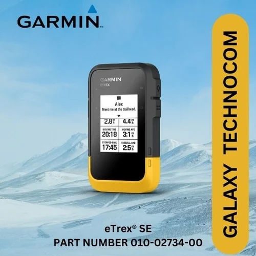
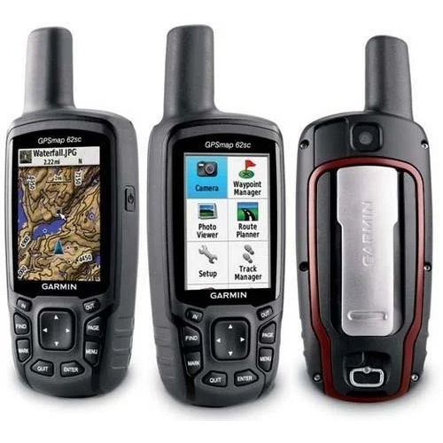
Presenting the glorious GARMIN eTrex SE GPS-now at a rare price cut, offering first-rate navigation technology for your adventures. This top-drawer handheld GPS boasts up to 168 hours of battery backup, high-sensitivity multi-constellation reception, and rugged IPX7 water resistance. Store up to 1000 waypoints and 50 routes, track every twist on the trail, and benefit from Bluetooth connectivity for seamless data transfer. The reduced price means explorers and outdoor enthusiasts can own a reliable, user-friendly GPS powerhouse designed for hiking, trekking, geocaching, and more.
Versatile GPS with Exceptional Outdoor Utility
The GARMIN eTrex SE GPS is engineered for explorers-perfect for navigation, hiking, trekking, geocaching, and trail mapping. Its rugged, water-resistant design ensures reliability in diverse environments, while the button-operated interface allows swift control. With GPS, GLONASS, Galileo, QZSS, and Beidou support, users receive precise positioning. Whether for search and rescue or adventure travel, this handheld GPS stands as a steadfast companion, offering robust utility and peace of mind for all your outdoor pursuits.
Efficient Supply & Ready Stock Availability
Our logistics team guarantees prompt delivery of the GARMIN eTrex SE GPS from the designated FOB Port in India, with stock ready for immediate fulfillment. Proposal amounts are tailored to meet client needs, ensuring quick dispatch for bulk or individual requirements. Each unit comes with authentic certifications to ensure compliance and quality assurance. With substantial supply ability, dealers and traders can confidently source this advanced navigation tool for their customers, backed by professional service.
FAQ's of GARMIN eTrex SE GPS:
Q: How does the GARMIN eTrex SE GPS enhance outdoor navigation?
A: The GARMIN eTrex SE GPS features high-sensitivity satellite reception, allowing users to precisely track routes and locations, making it ideal for hiking, trekking, geocaching, and search-and-rescue operations.
Q: What type of battery is required for the device, and how long does it last?
A: The unit operates on 2 AA batteries (not included) and offers up to 168 hours of use in standard mode, making it suitable for extended outdoor activities without frequent battery changes.
Q: Where can the GARMIN eTrex SE GPS be used effectively?
A: This handheld GPS can be used in a wide variety of environments-mountains, forests, trails, or urban exploration-thanks to its robust construction, water resistance (IPX7), and accurate satellite tracking.
Q: What are the benefits of Bluetooth connectivity on this device?
A: Bluetooth connectivity enables effortless data transfer between your GPS and compatible devices, allowing users to share tracks, routes, and waypoints conveniently without needing cables.
Q: What certifications accompany the GARMIN eTrex SE GPS units?
A: Each GPS unit is supplied with authentic certifications attesting to its compliance with industry quality and safety standards, providing assurance to traders and end-users alike.
Q: What is the process for placing bulk orders or proposals?
A: Interested buyers or businesses can contact our logistics team to discuss proposal amounts and place bulk orders. Our stock-ready inventory and efficient supply chain ensure timely and reliable delivery.




 Send Inquiry


 Send Inquiry